

Pilot Balloon - Meteorological Plotting Boards
Observations of a pilot balloon ascent, made by a theodolite are solved for wind speed and direction by graphical means using a plotting board. This method was used in the United States military and civilian weather services until the wide spread adoption of computer programs for solving the sightings. Boards like these were used with a standard slide rule as opposed to the U.K. Met. Office Pilot Balloon Slide Rule.
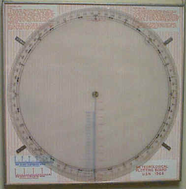
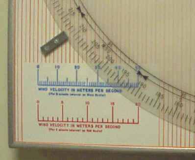
Below is a 1966 Navy pattern Meteorological Plotting Board (manufactured in 1982.) It measures 24" x 24". It has instructions for use imprinted on its surface and two wind speed scales. An almost identical model was produced at the same time as the one photographed labeled Meteorological Plotting Board U.S.N. 1981. Its construction utilizes plastic edges as opposed to the board below which has metal sides, it is a bit lighter but all other aspects of the board appear to be identical.
A board manufactured to a different specification was produced for the U. S. Weather Bureau. This board was called "Winds Aloft Plotting Board" measuring 35.5" x 35" it had 6 wind scales and did not include imprinted instructions for use.
 |
 |
Instructions:
1. Level and orient theodolite with zero setting in true north
2. Inflate Balloon to 180 m.p.m. ascensional velocity.
3. Release balloon and record azimuth and elevation angles each minute.
4. Compute horizontal distance by slide rule (Hor. Dist. = height of balloon
times natural cotangent of the elevation angle)
5. Plot the horizontal path of the balloon - Turn protractor until
first azimuth angle is on the arrow near the bottom of the board scale. Place a
dot offset from the center of the protractor by the proper horizontal distance
(read on red scale) and mark point on black reference line by placing a dot or
cross on protractor. Proceed in same manner with each set of minute
readings.
6. When the horizontal distance becomes greater than the limit of the red scale